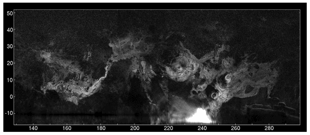
Above: Images of an asteroid passing Earth - not optical images, but images gathered by a unique kind of radio telescope. Courtesy of Space.com.
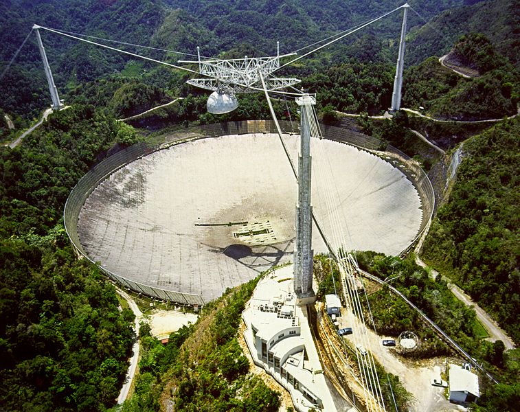 |
| Above: The Arecibo radio dish. If you’re thinking that it looks like the lair of a James Bond villain, that’s because it was. The dish appeared in the 1995 film Goldeneye. Image courtesy of NAIC. |
 |
| Above: A few of the observatories targets, as seen with its radar: Top is the surface of Venus, showing volcanic features and plains at 1 km resolution - like the planets thick clouds aren't even there. Bottom left is the craters at the north pole of Mercury, and the bright stuff in their bottoms is ice. Bottom right is the rings of Saturn, showing indirect evidence of the effects of larger ring particles, which make the image slightly lopsided. Courtesy of NAIC. |
John: How distant an object can the facility obtain a RADAR image of with a useful resolution?
Ellen: The detection of an object depends on the distance to the object, its reflectivity, and how fast it is rotating. Of these, the distance is the most important factor, usually, since the signal strength decreases with distance to the fourth power. The signal is spread out in Doppler if the object rotates fast, so that makes the signal weaker per channel. Arecibo has a practical limit that we can only point 19.6 degrees from the zenith, so we can only track an object over 39.2 degrees in the sky, or 2.6 hours or so. Light travel time to Saturn is about an hour, so that is about as far as we can detect something, since we can't follow it any longer than that. We have gotten radar images of Saturn's rings and Titan (transmit 20 min, wait two hours, receive 20min). Typically, we can image main-belt asteroids of around 50km at resolution of a few km, and near-Earth asteroids at 7.5m resolution out to about 0.05 AU, or about 25x the distance to the moon. There is a signal-to-noise calculator a http://www.naic.edu/~pradar.
John: Could you give me an example for a time when the facility worked in collaboration with instruments working at optical or other frequencies and what role it played?
Ellen: We do this frequently. First, near-Earth asteroids are discovered using optical telescopes (the sun is much brighter than our radar beam). We follow-up these discoveries, sometimes within hours to get much more precise orbits, and sometimes high-resolution images that reveal sizes, shapes, and spin rates of the object. We are also observing radar targets with the NASA Infrared telescope facility (IRTF) in Hawaii with a 0.8-5 microns spectrometer, to look at composition and thermal properties. We have looked at about 40 asteroids in the last 6 years or so, to study how important the irregular shapes of small asteroids are when analysing their thermal properties. Optical observations give us the rotation rate through lightcurves, but sometimes the solution is not unique. A radar observation can help distinguish between say a 12-hour and 24-hour rotation period, which is difficult to do optically (due to sampling limitations).
John: Could you give me an example of how the facility supports planetary science space missions?
Ellen: The target of the Osiris-Rex sample return mission, Bennu, was chosen because it had a shape model from previous radar observations. This made planning a mission to rendevous and orbit the body feasible, where a target about which nothing is known would be too risky. We have also looked at spacecraft themselves to determine rotation rates - when SOHO was launched, there was a problem with communication, and they thought that maybe all the reaction fuel had been used and it was spinning out of control. We looked at it with radar, determined that it was rotating about 2 minutes, not seconds, and thus it was not out of control. They regained contact, and the mission proceeded as planned.
John: What unique capabilities does the facility have?
Ellen: There are two planetary radar facilities in the world: Arecibo and Goldstone in California. Arecibo is more sensitive by a factor of 20.
John: Does the facility make discoveries independent of other observatories and planetary science missions or do you more often work in a support role and could you give me an example?
Ellen: We make discoveries, such as 2/3 of the known near-Earth binary systems were discovered by radar. We measured the tiny but important non-gravitational effects of radiation pressure on asteroids: the Yarkovsky and YORP effects through radar astrometry. (Chesley et al. 2013, and Taylor et al. 2007). We also support NASA Headquarters in doing orbit improvement for targets of interest as they are discovered. And we image near-Earth asteroids that are available to discover if they have satellites, and get shape models and detect surface features. We discovered the first near-Earth asteroid triple system, 2001 SN263, and imaged the components (Becker et al. 2015). I'm talking here about the planetary radar observations. Arecibo also does passive radio astronomy and Earth atmospheric science, and plenty of scientific discoveries are made in those areas as well.
John: What projects do have big hopes for over the next few years?
Ellen: We mostly hope that the facility can continue to do cutting-edge science despite uncertainty about future funding support. The radar studies of the planets and asteroids continue to uncover surprises, so there is lots of science yet to do. We are mapping the moon, which at radar wavelengths sees under the surface by meters, so combined with optical images it tells us about the geologic processes. Same holds true for Mars and Venus surface geology. Small near-Earth asteroids have more variable spin rates and shapes than larger ones, so we want to explore that further. We are now detecting over 100 objects per year, and could do up to 200 with increased personnel and telescope time.
John: Thank you ever so much for your time Ellen, and I wish you and the NAIC the best of luck for the future.
In these times, of flat or shrinking science budgets, older facilities like NAIC can look less sexy than brand new projects. Despite that, the capabilities of the dish at Arecibo are amazing– I’d heard about the NAIC, but never really appreciated how much it could do. A machine that lets us map the rings of Saturn, in real time, from Earth seems like an amazing gift to science and exploration, so here’s hoping they find the funding they need to keep going. If you’d like to express support for the NAIC, and you’re a US citizen, write a letter or e-mail to your congressman/woman and let them know you think there’s value in science having this capability!
 |
| Above: A map of the major volcanic regions on Mars, made by the NIAC. The only other way to see this view would be by sending a multi billion dollar spacecraft, and waiting months for it to arrive! |
Elsewhere in the Universe:
US military satellite explodes, cloud of dangerous debris: Civillian satellite spotters raise alarm first.
There was anger in some quarters after a malfunjctioning power source caused a semi-retired US military satellite to explode in a busy part of LEO - the US military was 'excessively' slow to report the accident.
UK set to get spaceport
...and one of the potential sites is near Glasgow, just an hours train ride from me!
Elsewhere on the internet:
Tiny spacecraft offered ride into deep space
Giant binoculars seeking origins of life
Are there better planets than Earth for life?
Exoplanet clouds analysed
No comments:
Post a Comment